Suggested Walking Directions
1. The starting point for the Walking Through Time tour is at the Welsh National & Universal Mining Memorial, Senghenydd. Postcode is CF83 4HA. Here you will find the first point of interest.
2. From the Welsh National Mining Memorial Garden, exit the garden through the gates, cross the road to the pavement and turn right. On the left is the site where the Sinkers Huts once stood.
3. From the site of the Sinkers Huts, cross over the main road and into the entrance to Nant-y-Parc School. The original Memorial is up the driveway on the left-hand side.
4. From the original memorial, walk back to the main road and turn left into Stanley Street. Aberdare Hall was located half-way up on the right-hand side.
5. Continue following Stanley Street around to the right. Noddfa Chapel was located on the left-hand side after the junction with Cross Street.
6. Continue south on Stanley Street until it meets High Street. Turn right onto High Street. On the left-hand side you will find the chapel previously known as Salem Chapel.
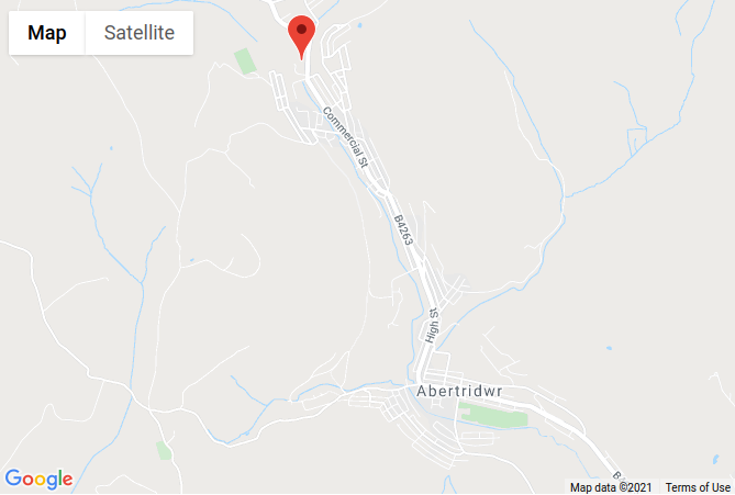
7. From the Square, by the war memorial, walk north-west up Commercial Street, and you will find the Leigh Hotel on the left-hand side.
8. With the Leigh Hotel on your left-hand side, continue walking up Commercial Street until you reach the bus stop. Here you will find the entrance to a footpath. Take this footpath to Kingsley Place. Turn left on Kingsley Place and walk to the end. Where Kingsley Place meets Gwern Avenue, you will find the original police station on your right-hand side.
9. With the original police station on your right-hand side, walk up the hill to the entrance of Plas Cwm Parc. This is the site of Senghenydd railway station in the early 1900s.
10. From Plas Cwm Parc, walk back down the hill on Gwern Avenue, passing the original police station on your left and continue until you reach the Parc Hotel (which is now Senghenydd Community Centre, and Aber Valley Heritage Museum) on the right hand side.
11. With Senghenydd Community Centre on your right-hand side, coninue walking down Gwern Avenue to Senghenydd Square. The location of the Gwern-Y-Milwr Hotel is at the end of Gwern Avenue.
12. The plaque for Senghenydd Square is found on the bus stop on the opposite side of the road to the Gwern-Y-Milwr.
13. From the bus stop, cross on the crossing, and follow Commercial Street to the left until you reach the next bus stop, which is outside the Church.
14. From the United Reform Church, cross the road and walk to your right. St Peter’s Church will be on your left.
15. From St Peters Church, Cross the road, and walk down the lane opposite. The lane will turn to the left - follow it and take the footpath on your right which leads past the skate park and children’s playground. When you reach the cycle path, turn left and follow the path until you see the Rugby Club on your left.
16. Continue walking on the cycle path, with the rugby club on your left. When you reach the second rugby pitch, follow the footpath to the left then turn left at T junction. Follow this road until you reach the Windsor Mining Memorial.
17. From the Windsor Mining Memorial on your left, continue walking up the road until you reach the Windsor Hotel on the corner of Caerphilly Road.
18. From the Windsor Hotel, turn right on to High Street and walk down the hill. When you reach the Brook Street on the left, turn left, and follow the road around to theright, past Cwmaber School and then to the right.
19. From Aber Valley YMCA, walk south on Brynhafod Road, and turn right on King Street. Continue straight over mini-roundabout and walk around the railings to zebra crossing by the old Panteg Hotel.
20. With the Panteg on your right-hand side, walk towards the square. Turn left into Church Road and you will find the Hall on the right-hand side as you start to walk up the hill.
21. From the Miner's Welfare Hall, continue to walk up Church Road, until you reach the old cottages on the right-hand side. Rhosyn Dy is now called Ty Watcyn.
22. With the cottages on your right-hand side, continue walking up Church Road until you reach the Royal Hotel on your left-hand side.
23. Continue walking past the Royal Hotel and turn left into Havard Road. Keep walking until you reach the crossroads with Francis Street, and turn left here. Walk to the end of the road and at the T-junction, turn left and walk until you reach the junction with Tridwr Road and Ilan Road. Here you will find the Aber Hotel.
24. Facing the Aber Hotel, walk down the road at the left-hand side, and down the steps on to the cycle path. Turn left. This was the site of Abertridwr Railway Station.
25. From the site of the former Railway Station, continue walking on the path until you reach Church Road. Turn right and walk down the hill to Abertridwr Square.
26. From Abertridwr Square, walk east on Thomas Street, and the old Nazareth Chapel will be on the left-hand side.
27. From Nazareth Chapel, continue walking east on Thomas Street. Beulah Chapel is on the right-hand side at the junction with Cross Street & Kings Close.
28. From Beulah Chapel, continue walking east on Thomas Street. Turn right onto Aberfawr Road. The site of Aberfawr Farm is on the right.
29. From Aberfawr Farm, head north on Aberfawr Road, the way you came, and then turn right on to Thomas Street. The old Food Store is at the junction with Aberfawr Road.
30. With the old food store on your right-hand side, walk approximately 230metres to Aber Mill, the final point on interest on this walking tour.
To return to the start, you can follow the main road (Thomas Street > High Street > Caerphilly Road > Commercial Street) for 2.4km/1.5miles. Or you can take the B bus.